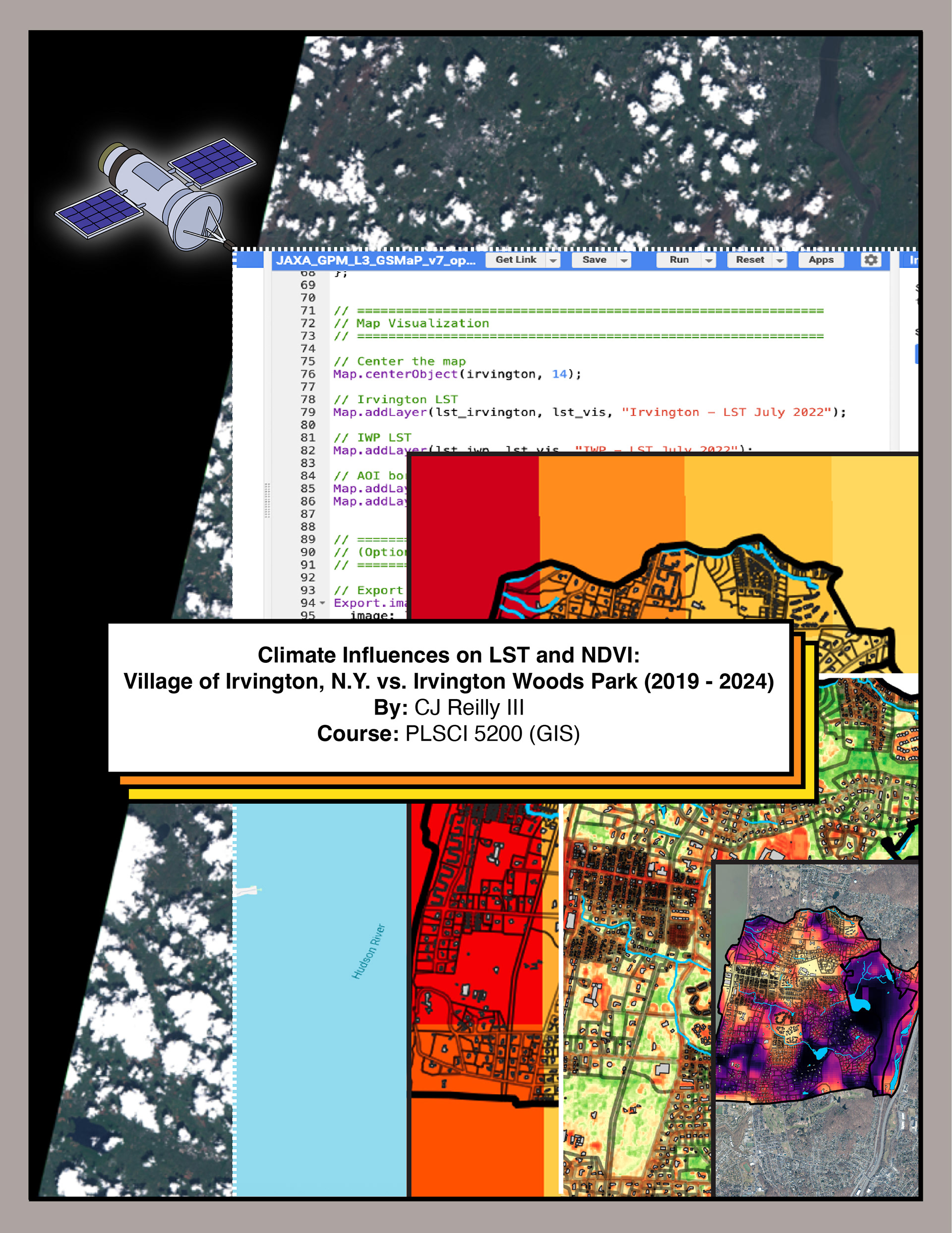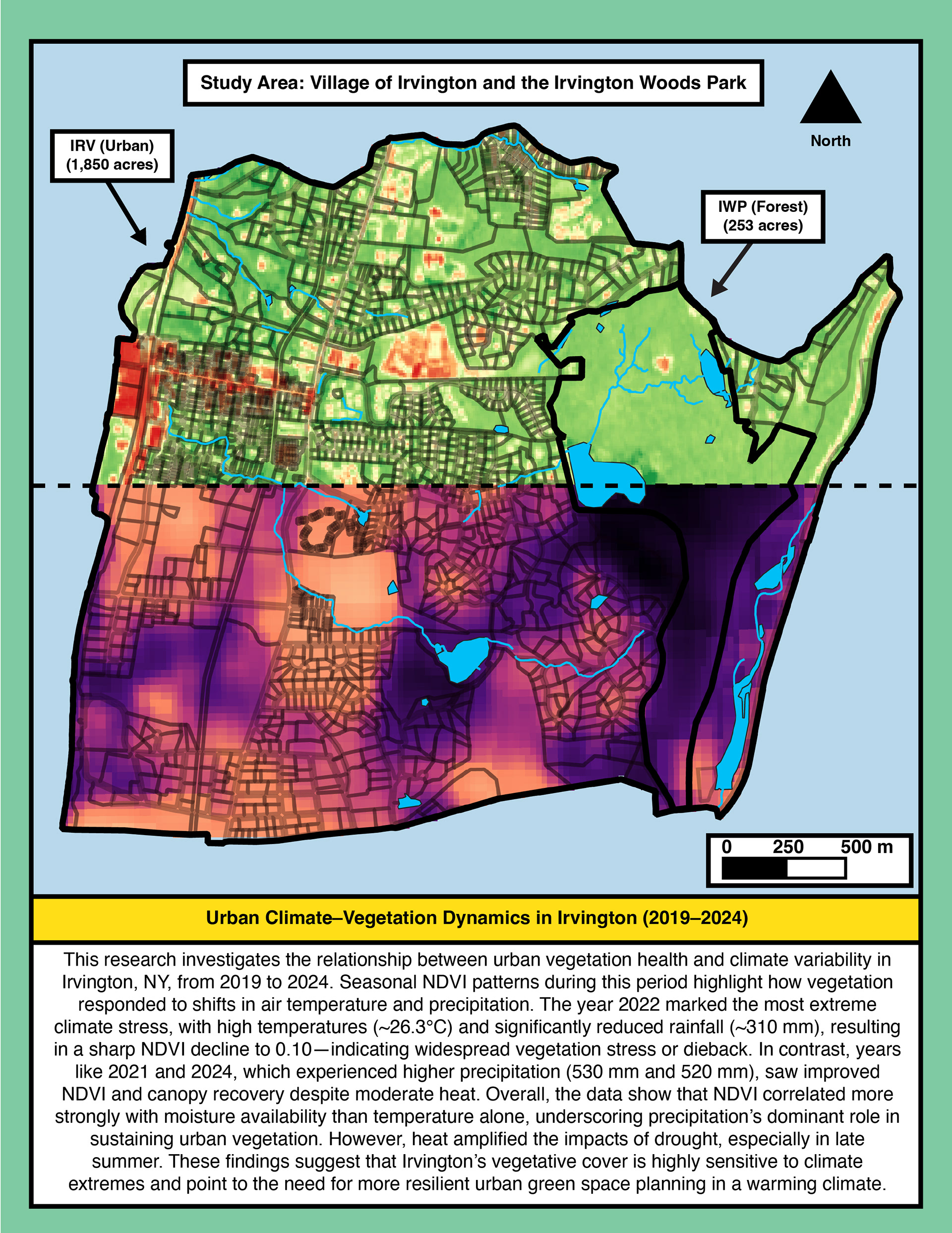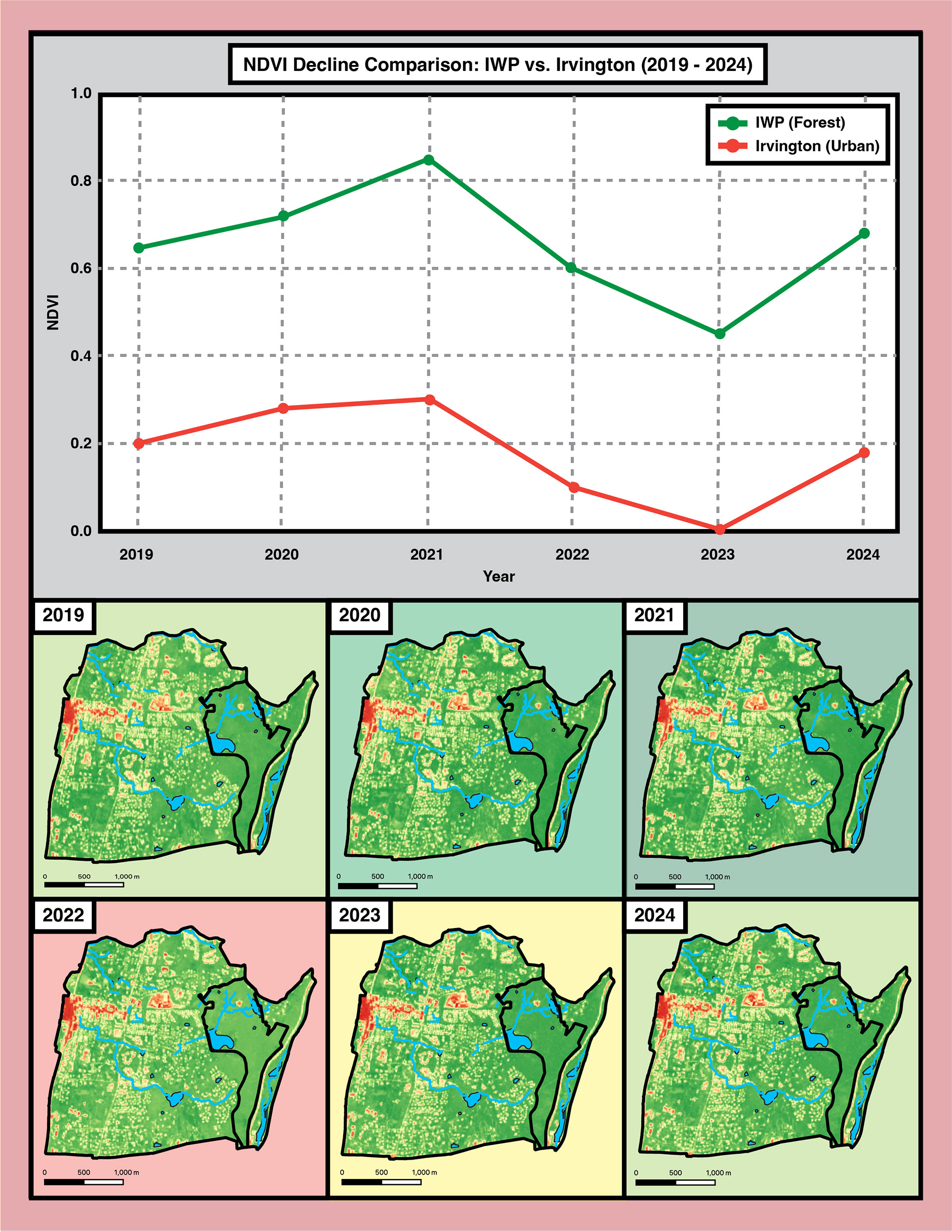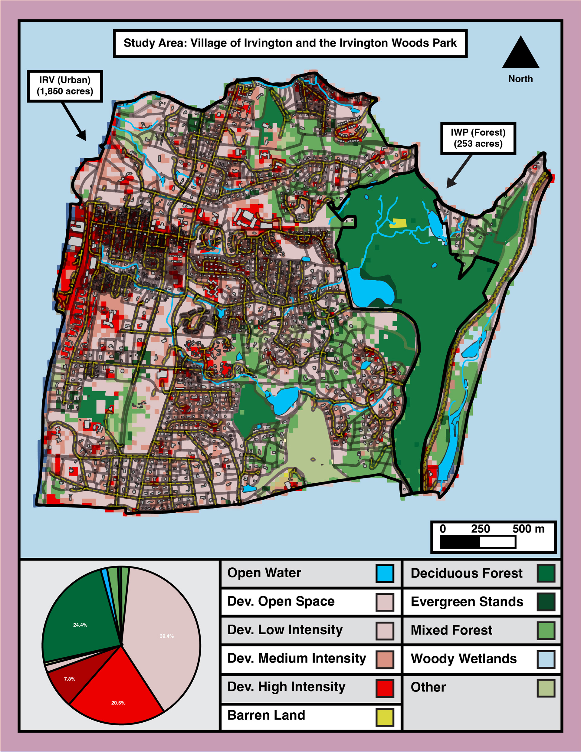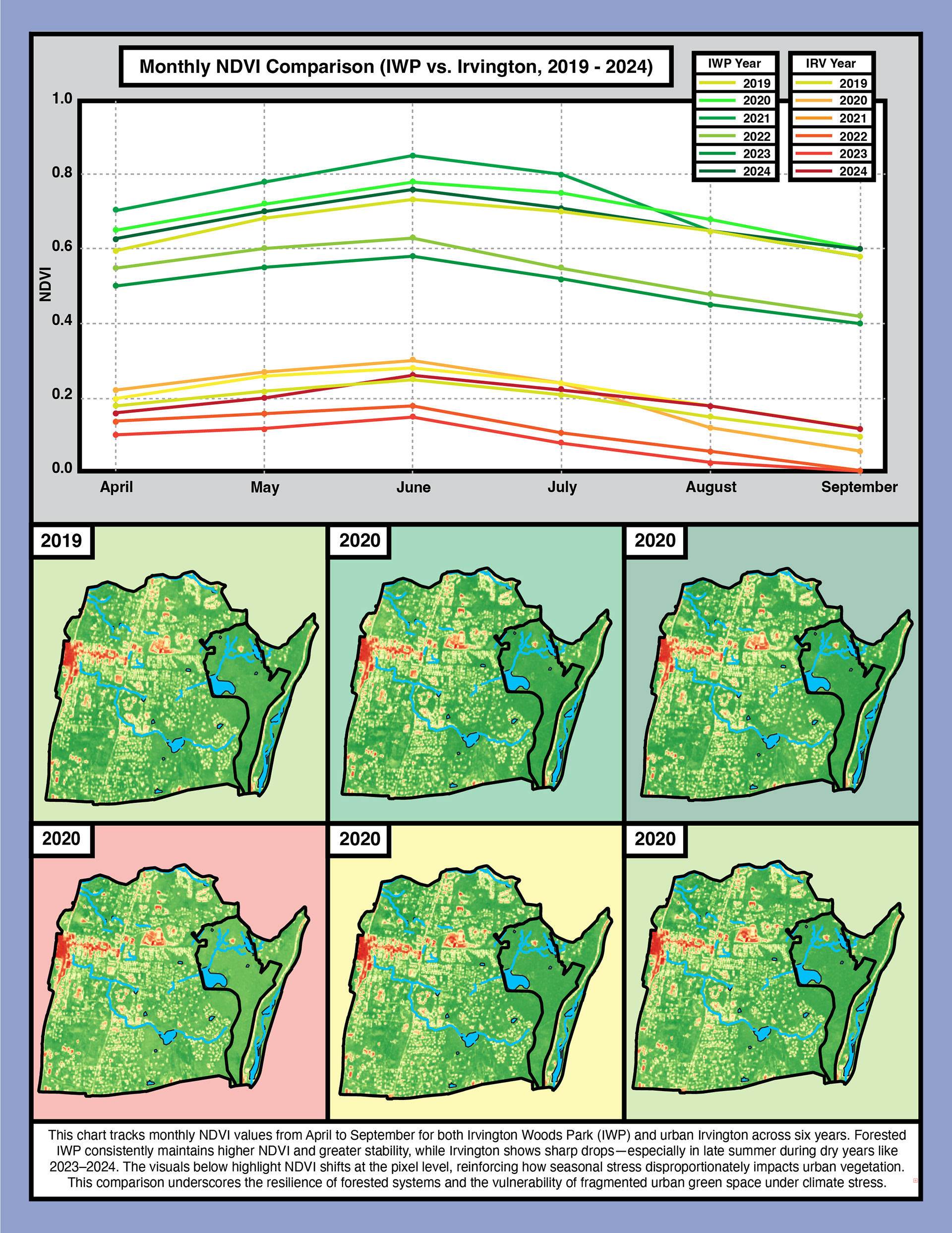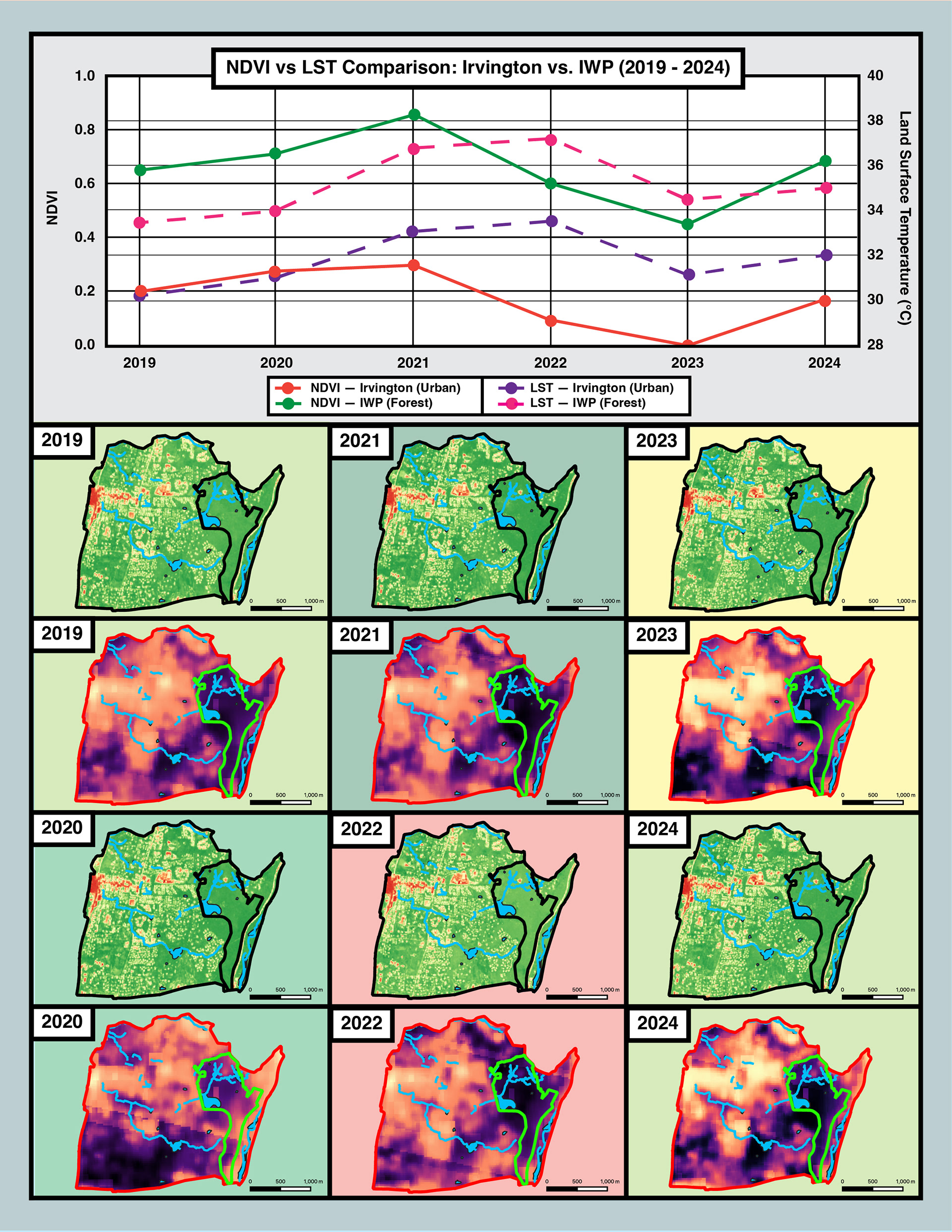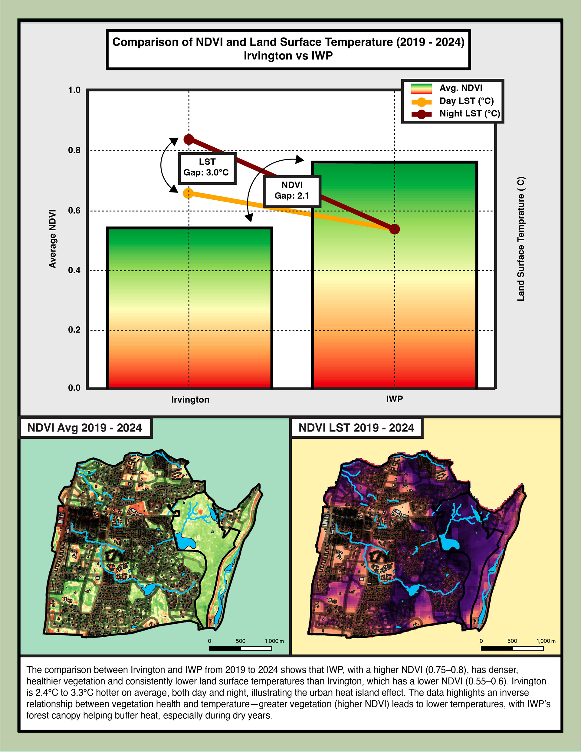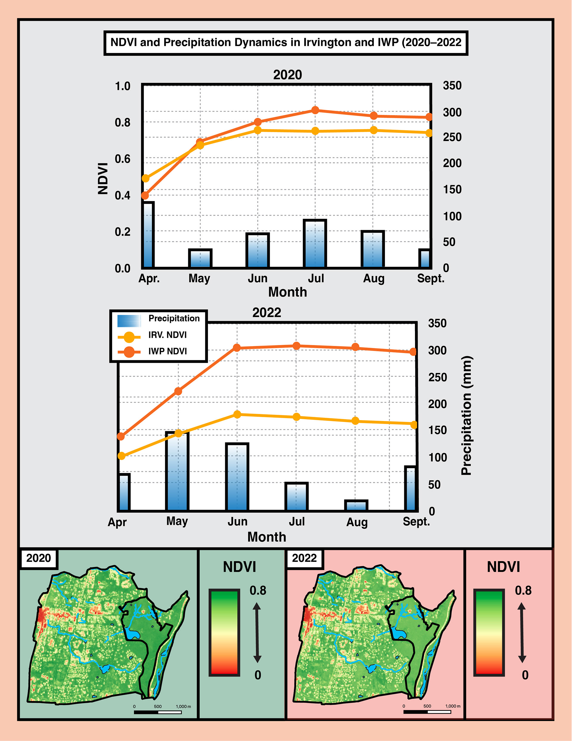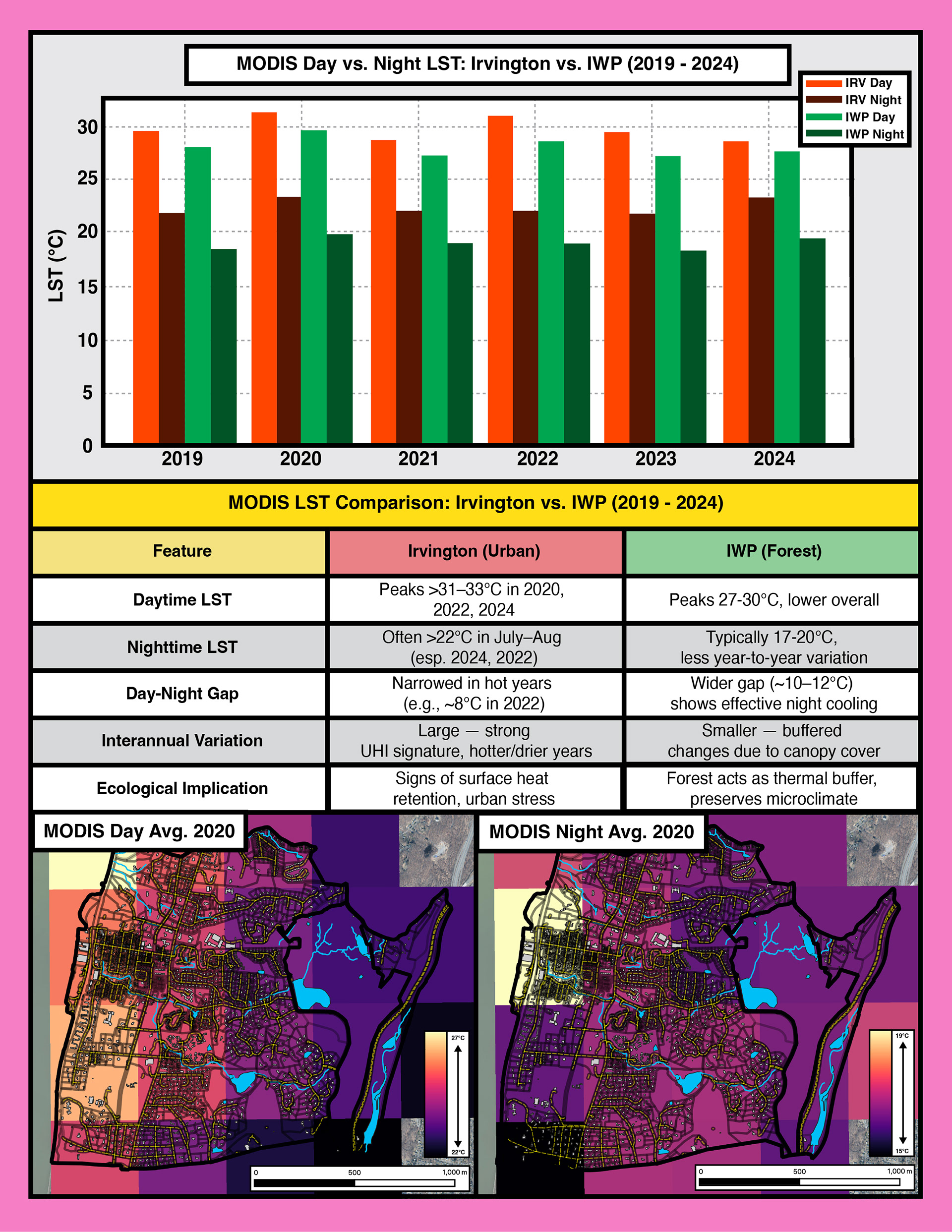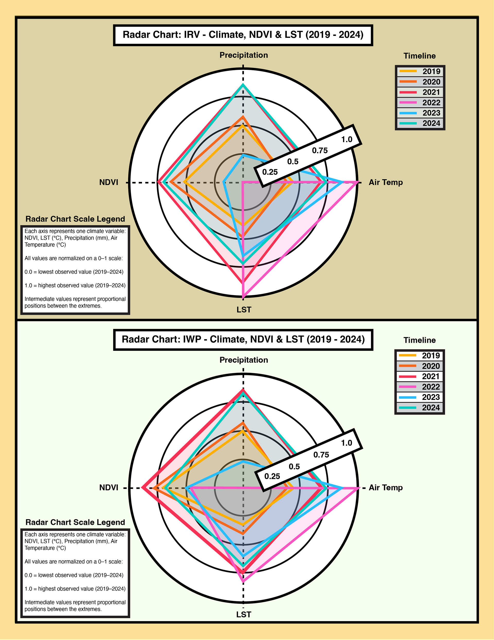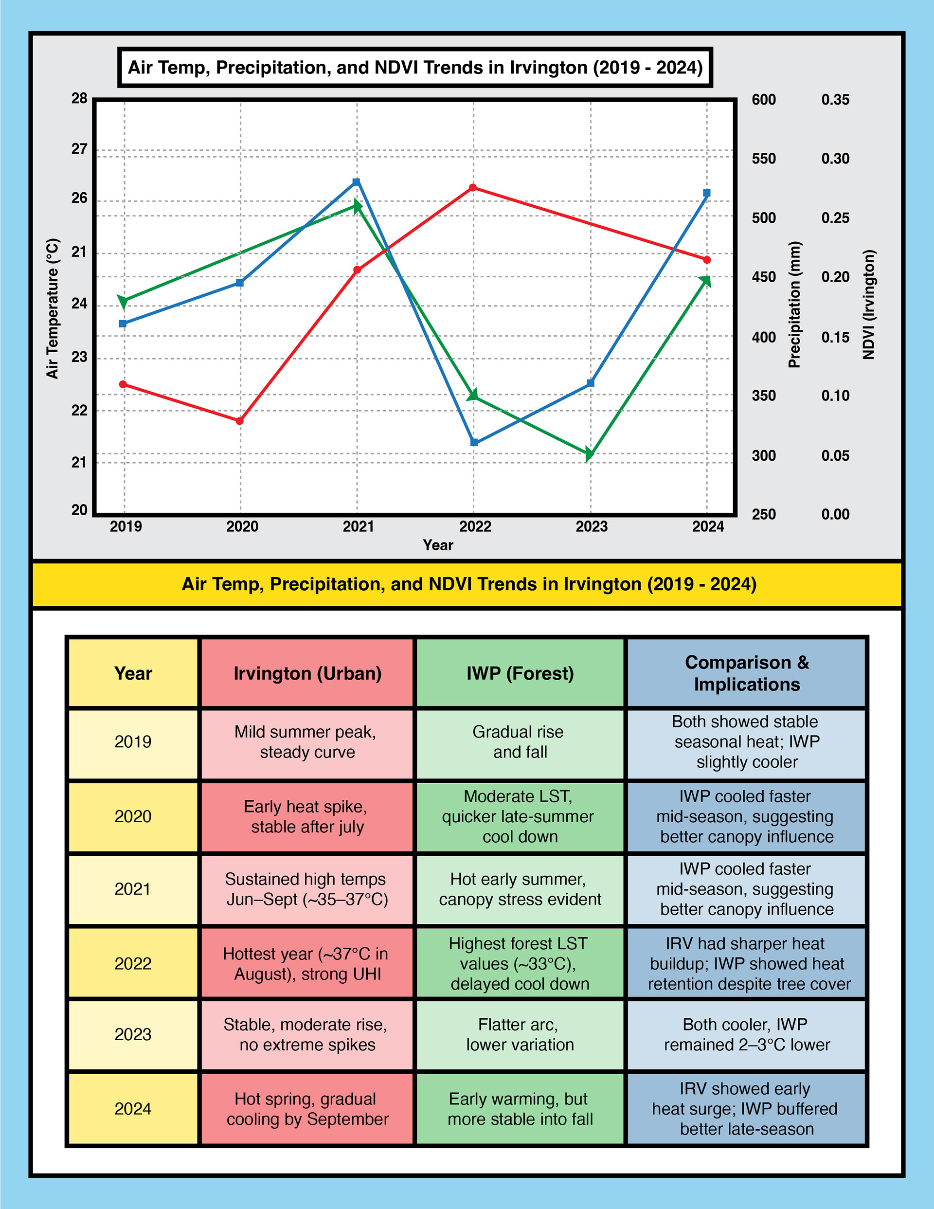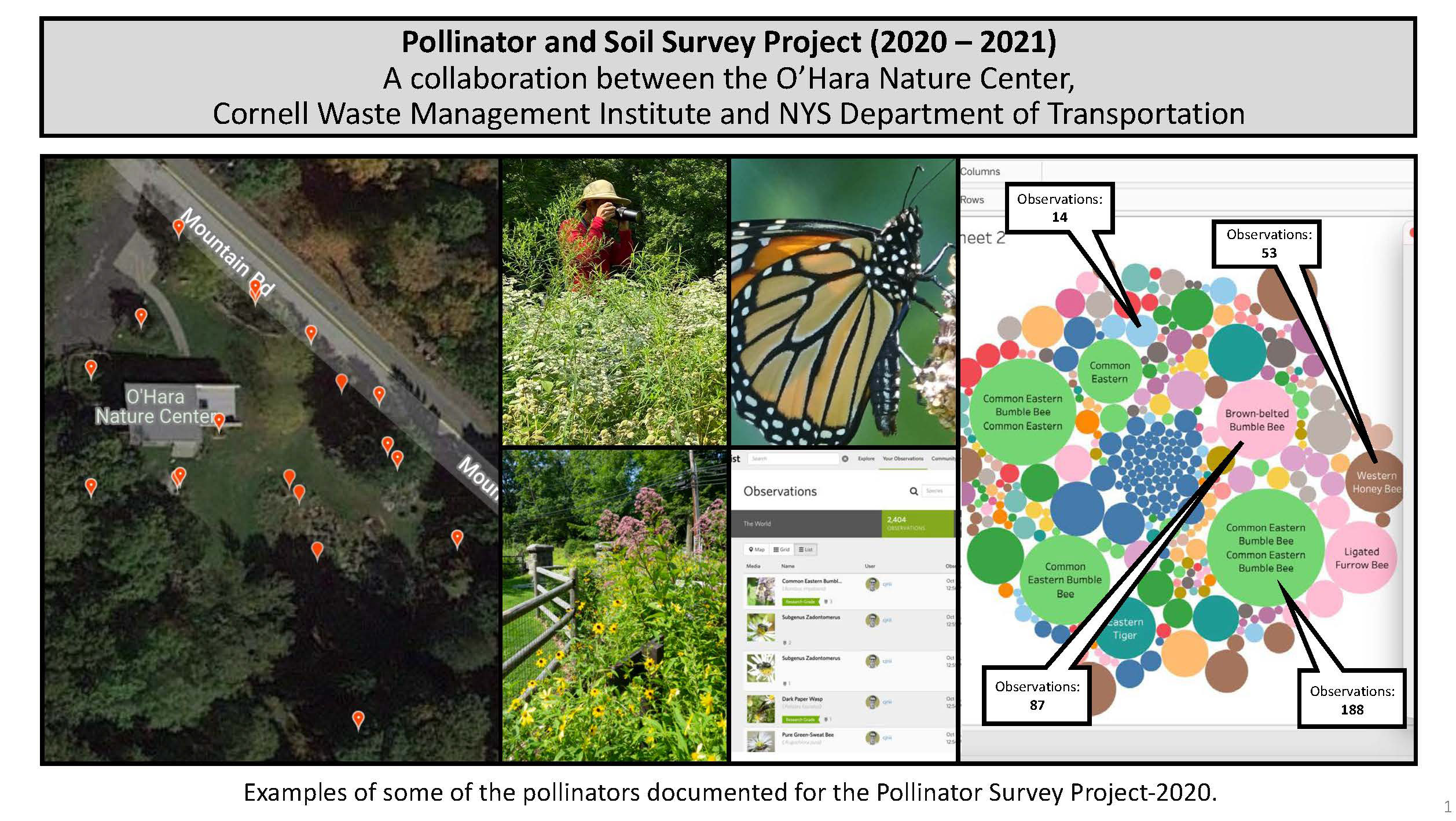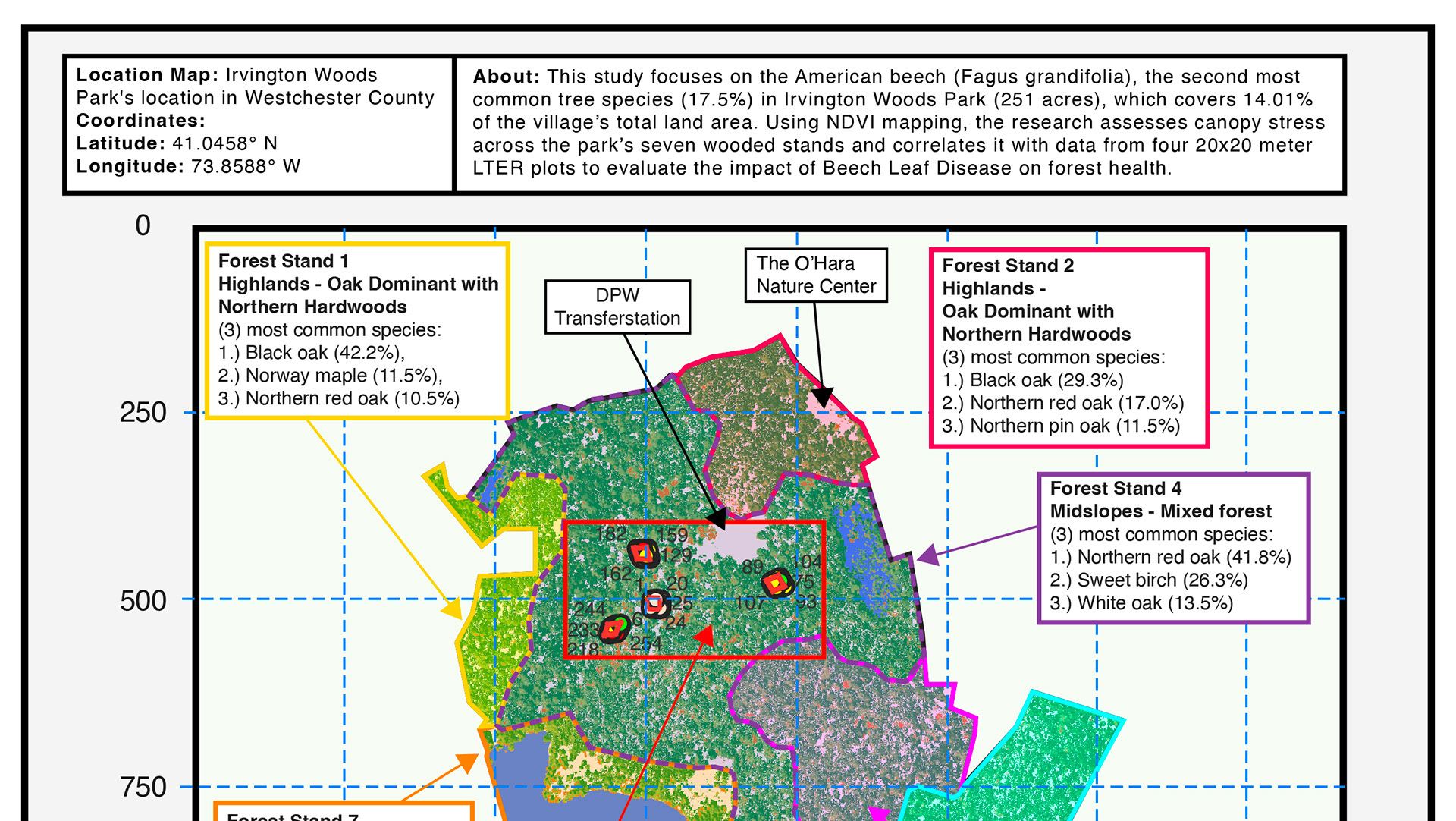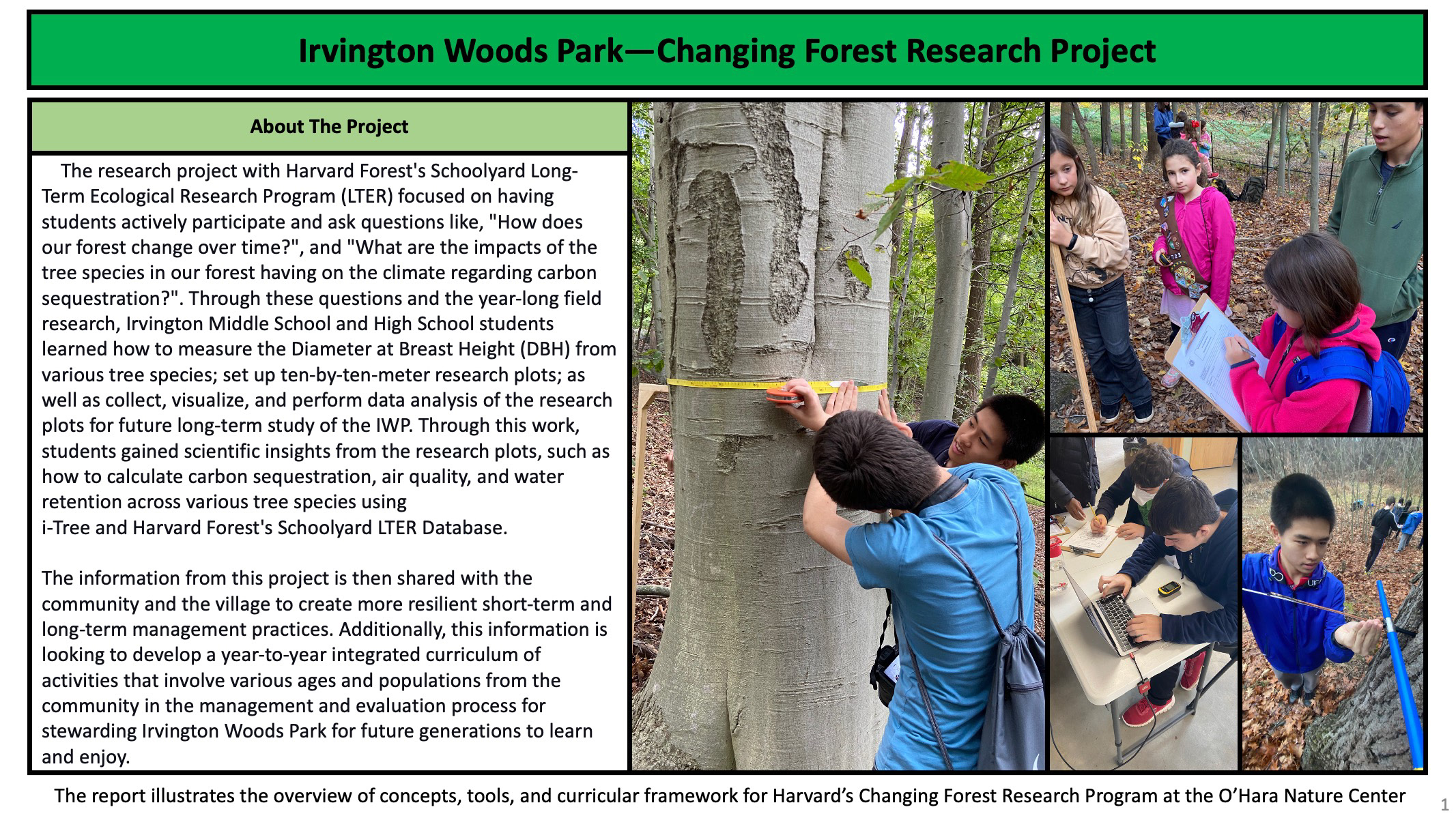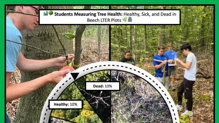
This comparative climate study examines how vegetation and temperature trends differ between the suburban Village of Irvington and the forested Irvington Woods Park (253 acres) from 2019 to 2024. The project uses satellite imagery and local weather data to track how drought and heatwaves impact NDVI (Normalized Difference Vegetation Index) and Land Surface Temperature (LST) in each landscape. The findings underscore the cooling role of forest canopies and the vulnerability of urban zones to climate extremes.
Key Highlights
📍 Location: Irvington Village & Irvington Woods Park, Westchester County, NY
🌿 Focus: NDVI & LST trends in forested vs. urban settings
🛰️ Methods: MODIS & Landsat data, NOAA weather records, GEE, QGIS
📊 Findings: Forested areas stayed cooler & greener, even in drought
🌡️ Insight: Urban zones showed higher LSTs & NDVI stress in dry years
🌱 Goal: Support local climate adaptation & green infrastructure planning
This page shares spatial analyses, satellite visuals, and charts to guide long-term ecological resilience in Irvington.
👉 Click here to view the full research paper
👉 Click here to view the full research paper