During my seven-month assignment with the Peace Corps Response Program, I served as a Rural Development Specialist at Cagayan State University (CSU) in Northern Luzon, Philippines. My primary responsibility was to support the university in meeting academic accreditation requirements set by the Board of Regents and the Commission on Higher Education (CHED) by accurately documenting CSU's property holdings through detailed land use maps.
Collaborating closely with campus deans, university administrators, and college CEOs, I worked alongside a team of faculty members to revise and enhance existing land use maps. Our efforts focused on improving accuracy by incorporating GPS boundary points, identifying agricultural development areas, and delineating existing, new, and future infrastructure.
To achieve this, we utilized a range of tools, including QGIS, Google Earth Pro, Adobe Creative Suite, AutoCAD, Google Mapulator, Garmin GPSMAP 64st, smartphones, and personal computers. The resulting land-use maps provided a comprehensive visualization of CSU’s short-term and long-term land-use plans, helping the university illustrate its infrastructure, land holdings, and resource management strategies—essential for accreditation and institutional planning. 🌐🗺️
Learn more about the land-use project and my experience here:
Unfolding Experiences and Everlasting Friendships – Philippines
Unfolding Experiences and Everlasting Friendships – Philippines
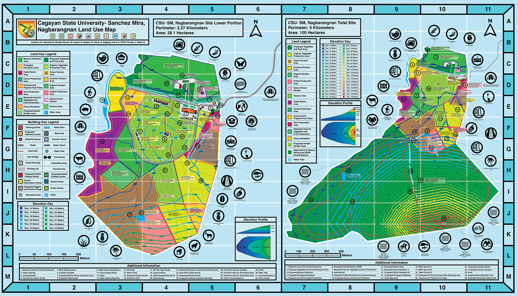
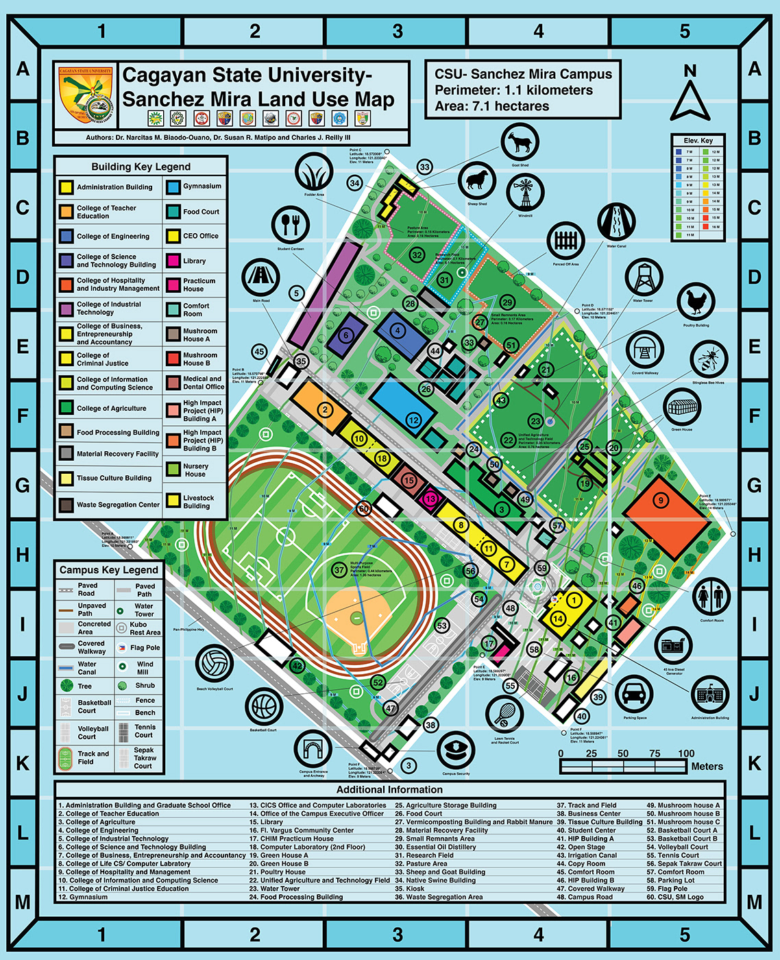
Cagayan State University- Sanchez Mira Main Campus Vicinity Map

Development of CSU- Sanchez Mira's Land Use and Vicinity Map
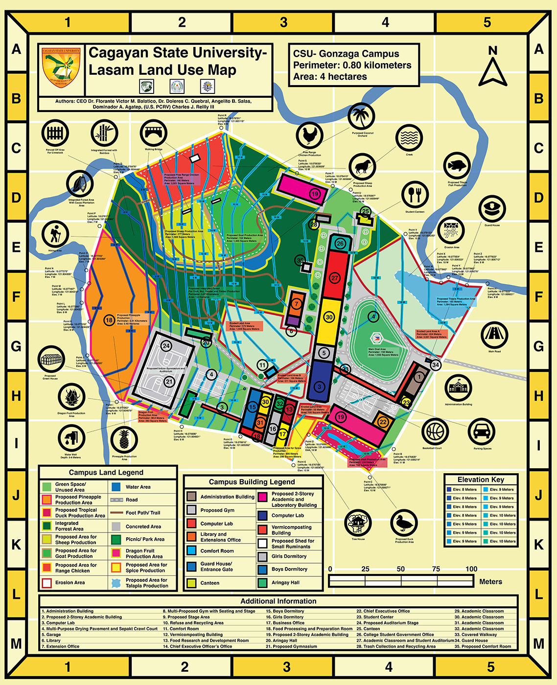
Cagayan State University- Lasam Land Use and Vicinity Map

Development of CSU- Lasam's Land Use and Vicinity Map
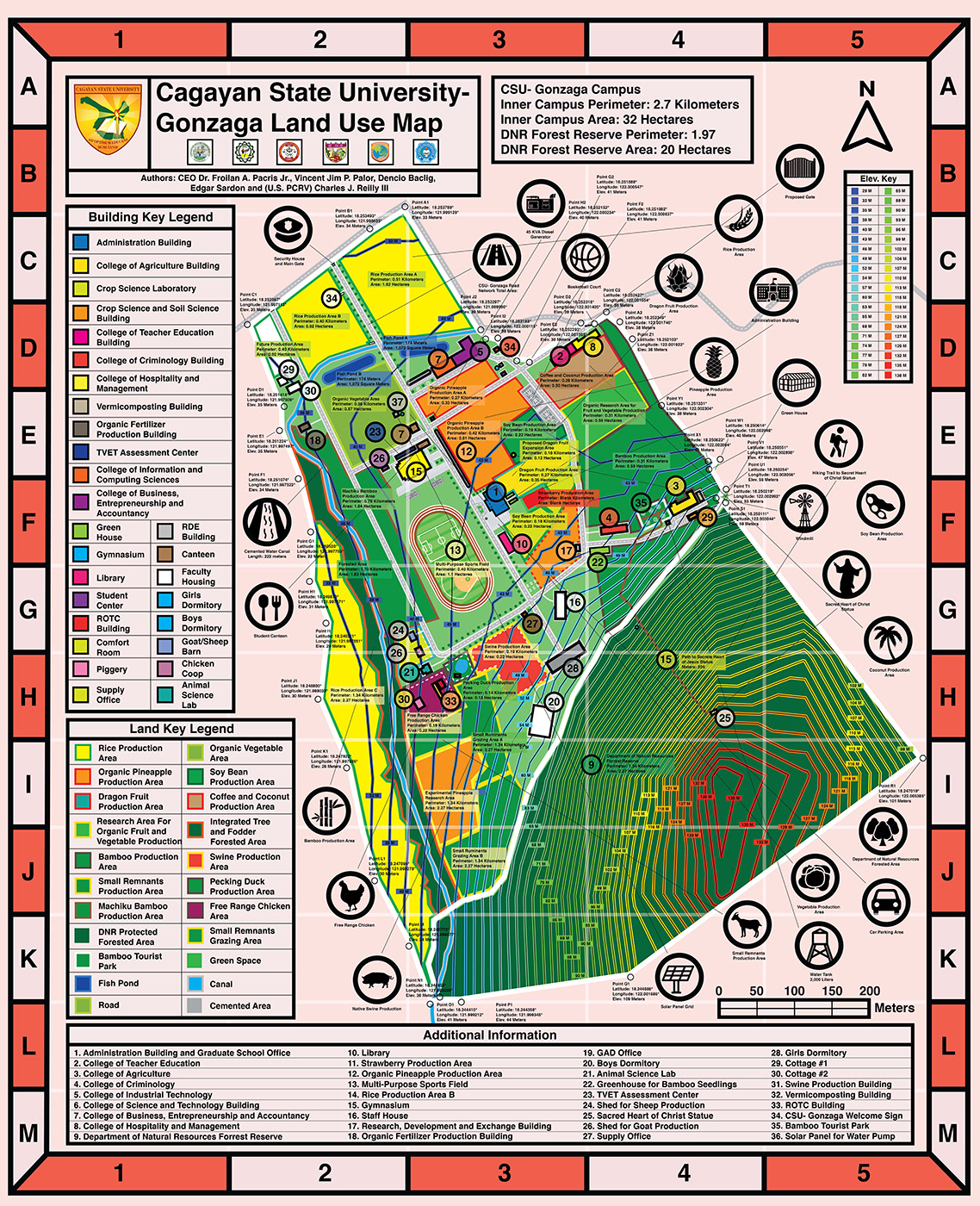
Cagayan State University- Gonzaga Land Use and Vicinity Map
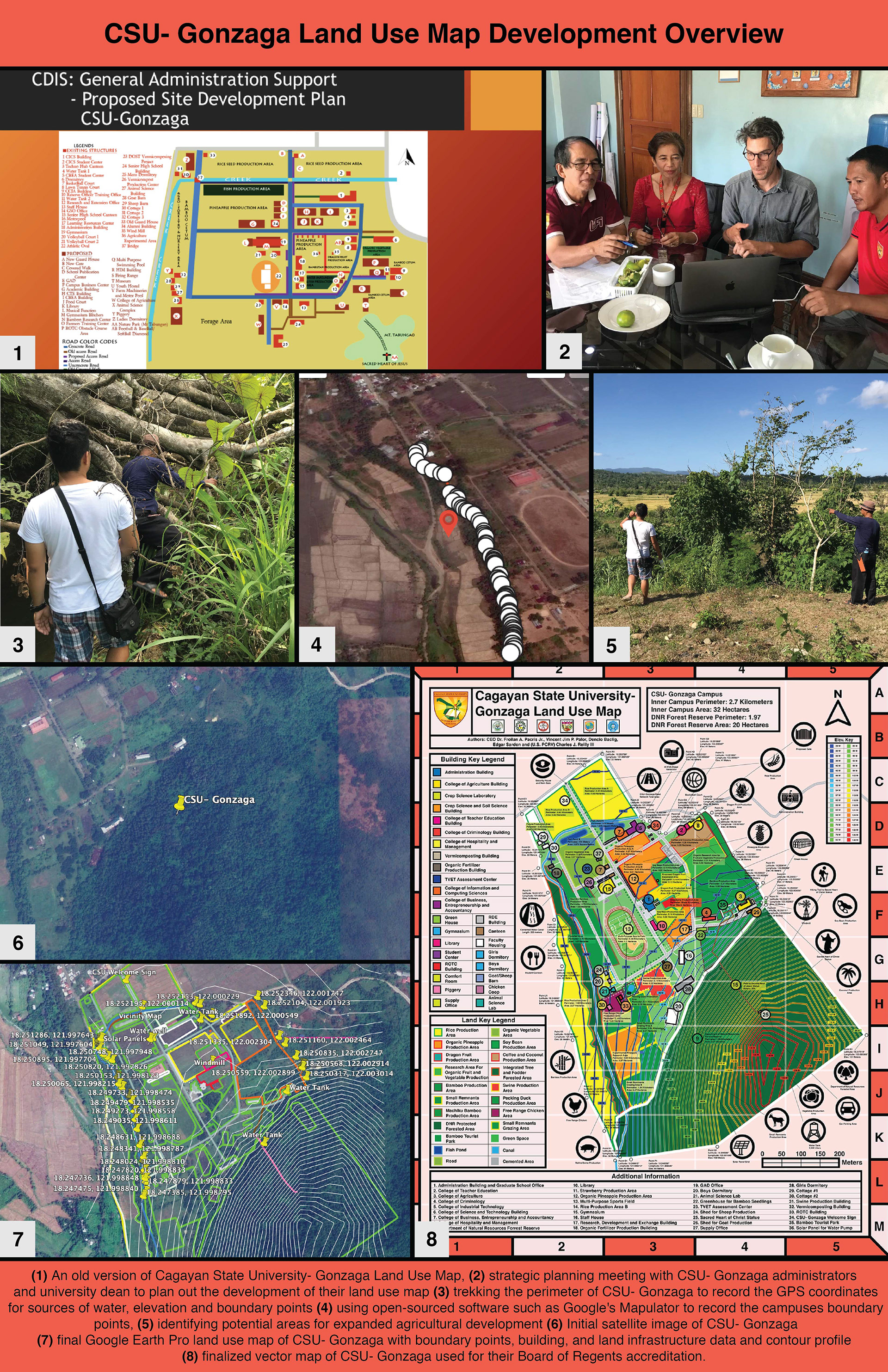
Development of CSU- Gonzaga's Land Use and Vicinity Map
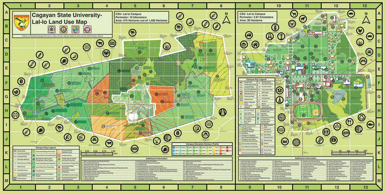

Cagayan State University- Lal-lo Land Use and Vicinity Map

Development of CSU- Lal-lo's Land Use and Vicinity Map

Cagayan State University- Andrews Land Use and Vicinity Map
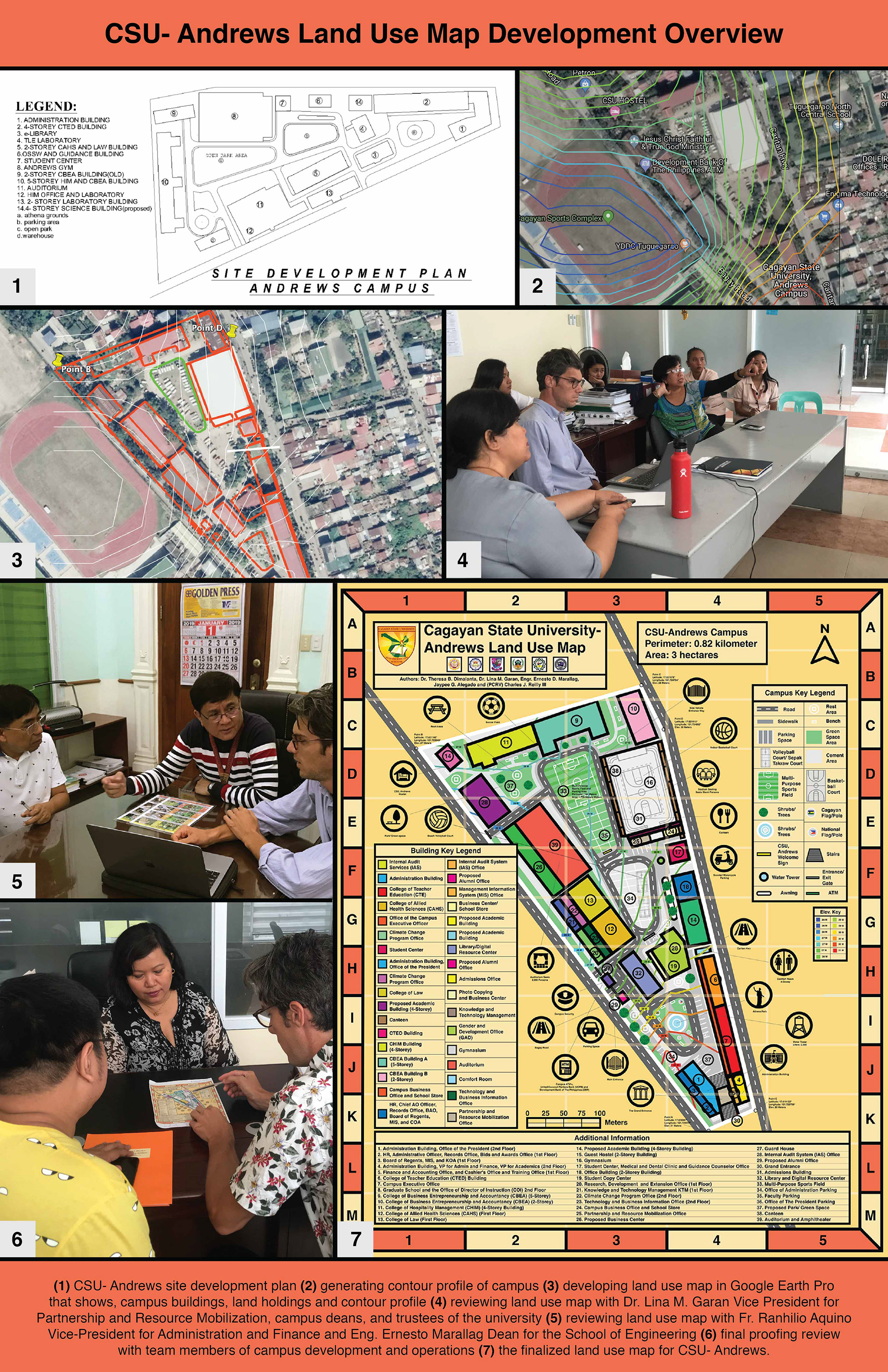
Development of CSU- Andrew's Land Use and Vicinity Map