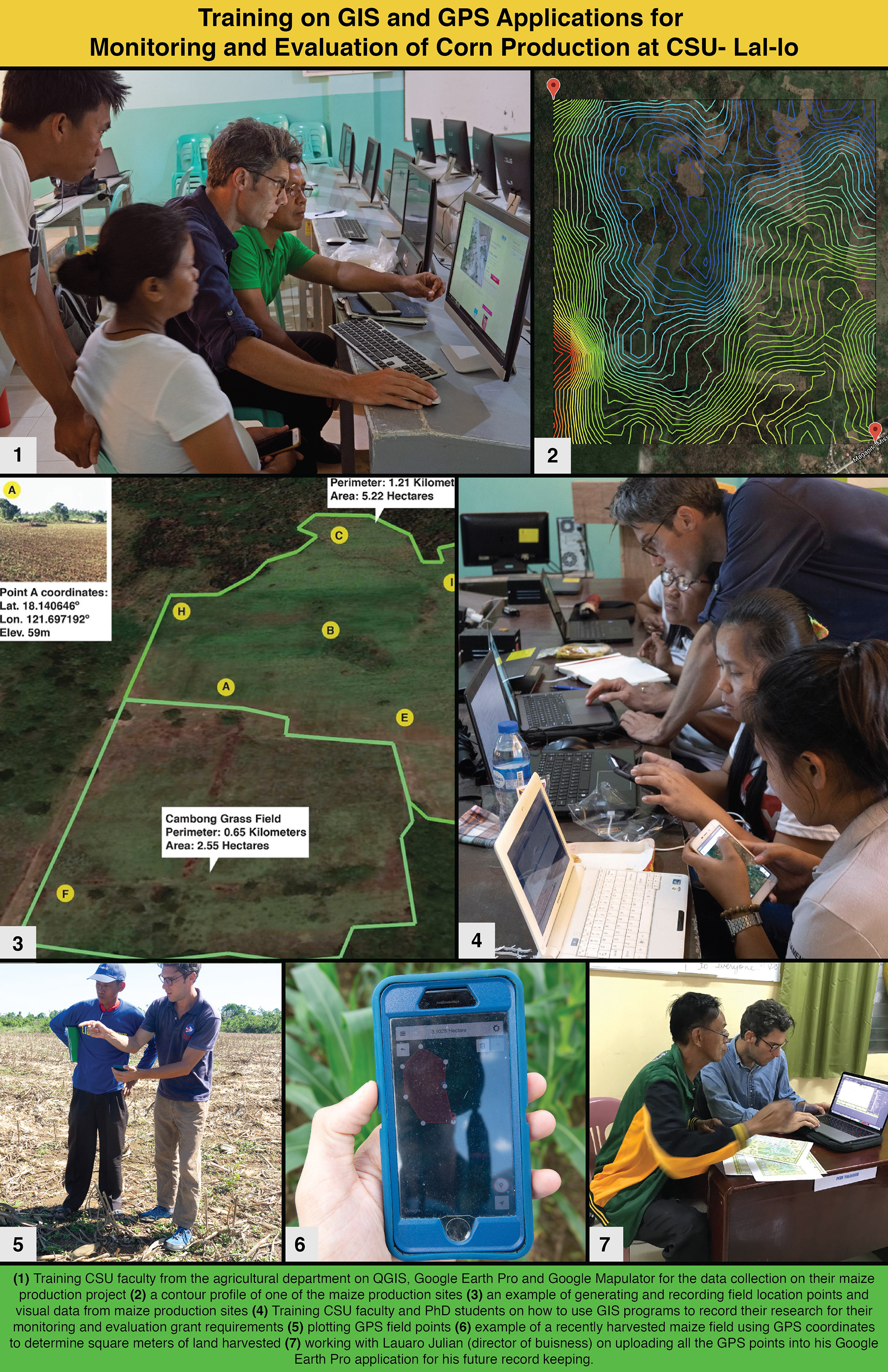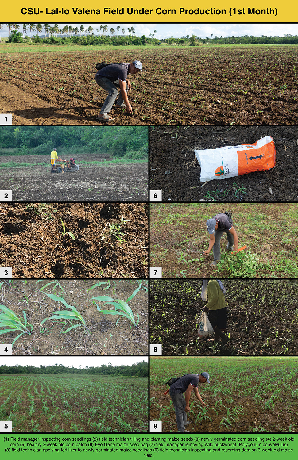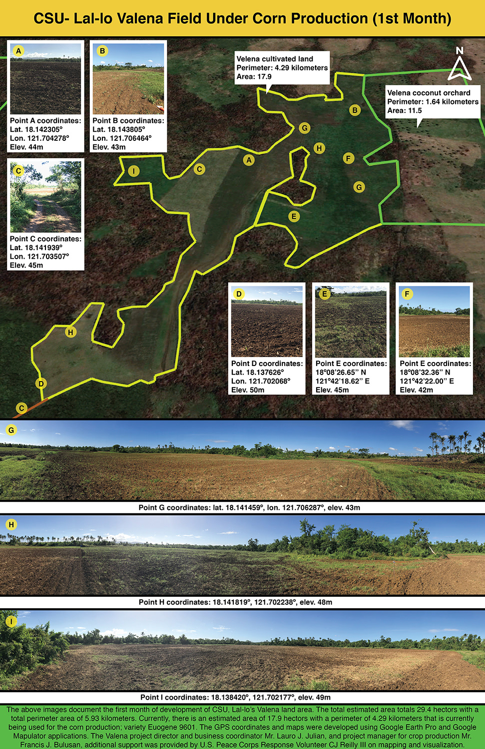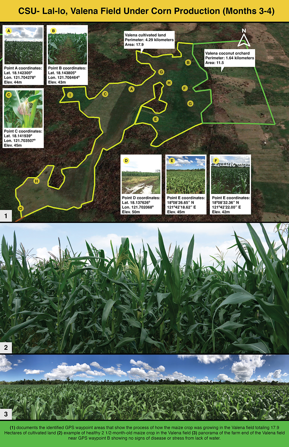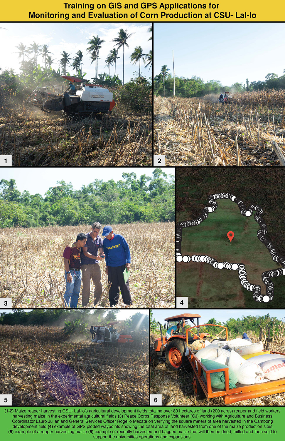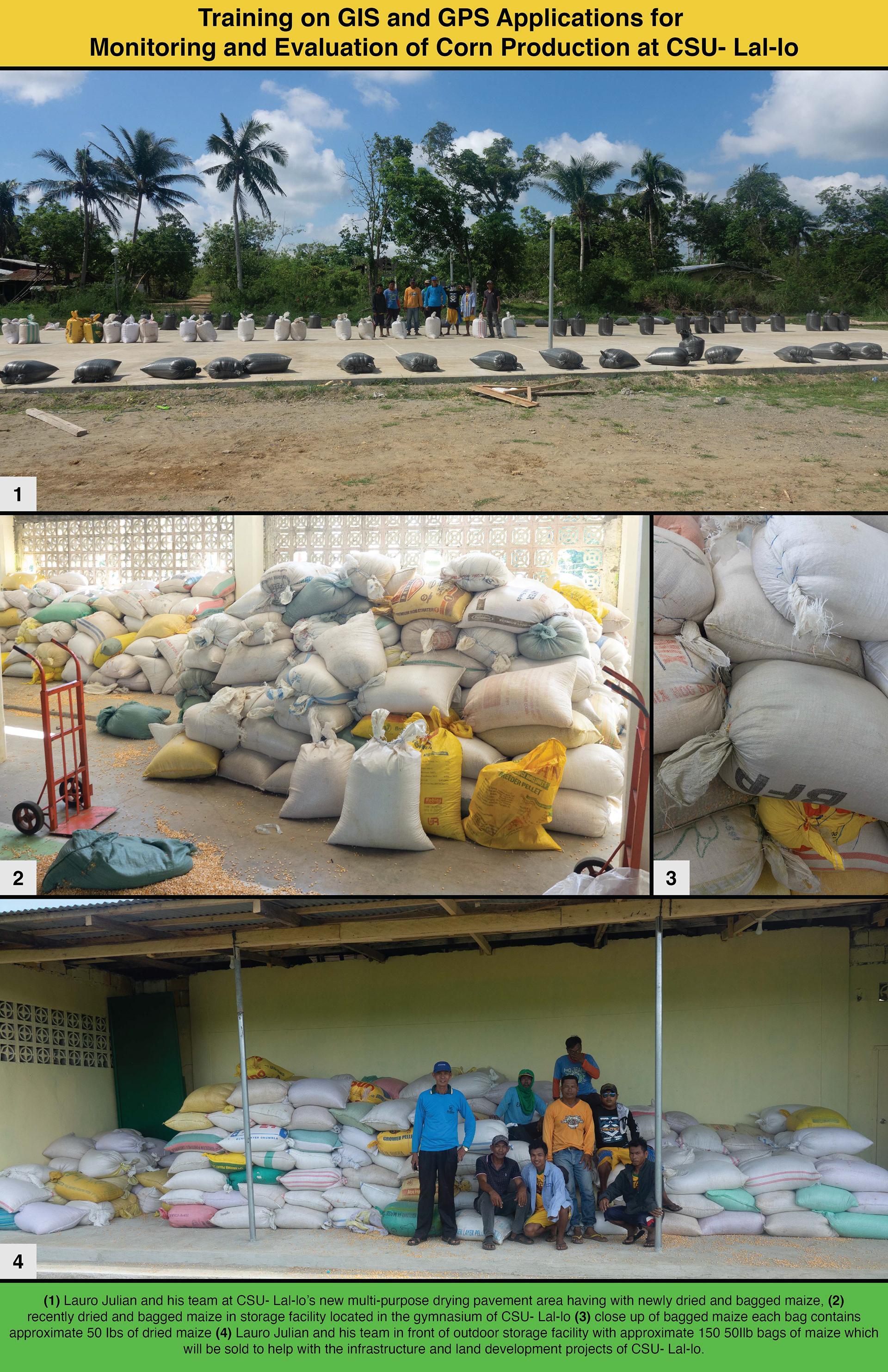
This project spanned five months at Cagayan State University, where I led a long-term GIS initiative to document the Agriculture and Business Department's corn production over 115 hectares (284 acres). The primary goal was to demonstrate how CSU-Lal-lo effectively utilizes its agricultural land to generate revenue, an essential factor since the university relies heavily on self-generated income. Stakeholders needed clear evidence of how the institution's natural resources were managed to meet its growing financial needs.
As part of the project, I trained students and faculty on Geographic Information Systems (GIS) tools such as QGIS and Google Earth Pro. I also provided hands-on instruction with GPS software and devices—including Garmin GPS readers and smartphones—so that staff could accurately capture field data. Working closely with a dedicated team of students and professors, we documented and analyzed the health and productivity of various maize farm sites. Our findings were compiled into PowerPoint presentations to monitor progress over time.
This documentation not only serves as a baseline for developing future farming sites but also provides stakeholders with reliable data to build confidence in CSU-Lal-lo’s agricultural strategies, ensuring continued support for the project. 🌽📈🌱🤝